Leaderboard
Popular Content
Showing content with the highest reputation on 26/04/22 in all areas
-
Fish finder pics
elmoputney and one other reacted to carpepecheur for a topic
The way I use a Deeper is to search for a mark, towing it behind a bait boat. When I am over the mark, I drop a self levelling marker float from the bait hopper plus some bait at the same time. I think we should call these devices echo sounders. "Fish finder" is a misleading marketing description.2 points -
Fish finder pics
elmoputney and one other reacted to kevtaylor for a topic
2 points -
1 point
-

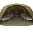
New bivvy time !
salokcinnodrog reacted to kevtaylor for a topic
Yes - I now have a use for it and a puppy to play goal keeper! 👍1 point -

New bivvy time !
kevtaylor reacted to elmoputney for a topic
That's a mad amount of weight for a bivvy, wouldn't want to barrow that too far I always think they look good if you fancy having a kick about though the front would make a good set of goalposts1 point -

New bivvy time !
elmoputney reacted to kevtaylor for a topic
OK mines the 1 Man Standard, used it about 3 times - for sale! Plus points: Good fabric, well made throughout, goes up quick, good ventilation - struggling here! Minus points: WEIGHT, packdown size for transporting (Looong car or van required), internal size - just fits in my Solar bedchair - touches poles both sides - leaving about 1.5 feet spare in front of the bed, 2nd skin - pointless as it only covers the top not the sides. This is the big 1 man, not the compact and only my opinions.1 point -
I've been looking at the Ridgemonkey 1 Man compact...1 point
-

Fish finder pics
kevtaylor reacted to elmoputney for a topic
You still have the same bankside references with a deeper though, to me it is basically like a marker float only one that tells you a little more info Sadly I doubt your map would still be accurate, the pads and weed has changed a lot of previously great features, I tend to use my deeper as and when I need to find a spot,a rarely even look at the maps I've made, tbh I have used a bare marker lead and a deeper on Virginia both have a place because I don't think either tell you the complete story1 point -
Fish finder pics
carpepecheur reacted to ... for a topic
I dont necessary use for fish, try to find spots, holes,bumps etc.... If fish are there/near then a bonus. Like at weekend, if I didn't use the Deeper, I wouldn't of known about how much weed was in that place without it, I did also drag a lead through, it did help to find smaller weedy areas.1 point -
Fish finder pics
... reacted to salokcinnodrog for a topic
With all the posts on this thread, I'm glad I split it away from the Tackle and Equipment thread it was on. I found the difference in water depth was easy enough from the bank WITHOUT a fish finder, in fact probably easier, as mapping by hand (if anyone ever saw my Earith map @elmoputney ) and with a marker float you have bankside references or aiming points, whereas with the Deeper you would still have to reference it in note form. The high and low water points can be quite off putting. I think Earith lost a metre of water depth, and Alton was 3 or 4metres, and you could gain an extra 10metres of bank as the water dropped, however some features that produced fish in full reservoir times, could also produce in low water times, yet some were totally above water when the water was low. A feature that produced fish when it was 8ft deep, (marker float counting hence in feet) still produced when it was 20ft deep. I mention cross references in note form, on the Deeper can you put in GPS positions or does it have to be additional notes? Obviously reason I ask is that sea going boats do have regular fishing marks that captains use and fish regularly, and they would have to be GPS.1 point -
1 point
-
I've gotta get one, we've used my mates on a deep pit but didn't find any fish of note but worked perfectly showing weed, depth and bottom variation. We also hung it over the side of the boat whilst predator fishing - brilliant having the fish shapes and ding noise when a shoul passes under - so exciting, but I think you can change that to the arches you see on other systems and that can show if a fish is big or not more accurately apparently- I no nothing just starting out so could be getting mixed up. This is a poor photo taken off the screen of a Lowrence system, not sure which but I love the detail of the wreck we were fishing and in some pics you could clearly see the Zander- what a day, loved it. Will try to get better pics next time.1 point
-
1 point
-

Fish finder pics
... reacted to carpepecheur for a topic
In my day, the equipment needed to do everything the Deeper does now, cost several tens of thousands of pounds and weighed around 200 kilos. For me, the Deeper is a miracle in a tennis ball. The biggest omission is not to be able to put in a tide height. This means that if your water level changes between sessions, as it does on the big reservoirs near here, you can't match up surveys done at different times of the year.1 point


